Lao PDR

  • September 06, 2017
    MRC

    Transboundary Fisheries Management Issues in the Mekong and Sekong Rivers of Cambodia and Lao PDR

    Share link

    This technical report describes priority issues for fisheries management in the Mekong and Sekong Rivers along the borders of Cambodia and Lao PDR. It cites exploitative fishing practices, habitat degradation, and lack of fisheries data and their sharing between two countries’ affected provinces as some of the key issues identified. This is a joint paper produced by the two countries under the Mekong Integrated Water Resources Management Project. 

    MEKONG​-SEKONG​-issue​-paper​-Final​-7​-Sep​-17​-for​-web.pdf (3 MB)
  • February 27, 2017
    ADB

    Tourism Sector Assessment, Strategy, and Road Map for Cambodia, Lao PDR, Myanmar and Viet Nam (2016 – 2018)

    Share link

    This report documents tourism sector investment priorities of ADB and the governments of Cambodia, the Lao People’s Democratic Republic, Myanmar, and Viet Nam.

    The assessment highlights sector performance, priority development constraints, government plans and strategies, past ADB support and experience, and other development partner support. It provides sector background information for ADB's investment and technical assistance operations and will be updated as strategic developments and program changes are needed.

    Click here for more detail.

    clmv​-tourism​-sector​-assessment.pdf (1 MB)
  • November 30, 2016
    Ministry of Natural Resources and the Environment

    Lao PDR National Biodiversity Strategy and Action Plan 2016 – 2025

    Share link

    National Biodiversity Strategies and Action Plans (NBSAPs) are the principal instruments for implementing the Convention at the national level (Article 6 above). The Lao PDR’s first National Biodiversity Strategy and Action Plan (NBSAP) laid out an action plan to 2010 and strategy to 2020, which consisted of seven programmes; (1) Scientific Data and Biodiversity Knowledge Development; (2) Biodiversity Management; (3) Human Resource Development Institutional; (4) Public Awareness and Involvement; (5) Institutional and Legal Frameworks; (6) NBSAP Implementation and (7) International Cooperation. Under those 7 programs, 27 objectives are to be achieved by 2020 and 203 actions were also identified which were to be undertaken by 2010.

    la​-nbsap​-v2​-en.pdf (2 MB)
  • November 30, 2016
    Ministry of Natural Resources and the Environment

    Lao PDR National Agro-Biodiversity Programme and Action Plan II (2015 – 2025)

    Share link

    The first National Agro-Biodiversity Programme, running from 2005 to 2012, was designed to serve as the framework for the effective conservation and management of agro-biodiversity. Although it was successful in raising awareness on agro-biodiversity and was instrumental in developing a number of projects designed to address agro-biodiversity issues, it had a number of shortcomings. Most importantly, there was a lack of a broad stakeholder involvement, resulting in inadequate GoL and donor funding support for the programme. There was also insufficient coordination and information exchange, particularly with focal points of international treaties and among the different technical components of the programme. Implementation arrangements were weak and became outdated with the creation of MoNRE and the reorganization of MAF.

    NABP​-II​_ENGLISH.pdf (1 MB)
  • August 01, 2016
    Asian Development Bank

    Video: New Road in Lao PDR Changes Everything

    Share link

    The Lao People’s Democratic Republic has built a new road with help from ADB linking the tourist town of Luangprabang with the country’s border with Thailand. Finished in 2014, the 367-km road provides access to goods, services and jobs and new businesses are flourishing along its length.

    Watch the video.

  • May 16, 2016
    Mekong Institute

    Development Potential for International Shipping on the Lancang-Mekong River (China, Lao PDR, Myanmar and Thailand)

    Share link

    The Greater Mekong Subregion (GMS) has seen rapid economic growth of its country membersduring the past two decades, especially the effectiveness of the ASEAN-China FTA. Together with adeeper and greater economic integration process in line with the ASEAN Economic Community(AEC) blueprint, the implementation of the Lancang-Mekong (LM) Cooperation Mechanism, China’s“the Belt and the Road” initiative, and other regional and subregional cooperation frameworks, thereis a greater demand for the development of transport and logistics infrastructure as well as serviceslinkages where the logistics and transport multimodal have been applied and developed in the region.

    In the new development context, Lancang-Mekong (LM) River, as a key part of the GMS transportnetwork, plays a crucial role in transport connectivity between the upper and lower riverine countriesthrough the waterborne navigation system. This navigation system is now fronting both opportunitiesand challenges that have drawn greater attention from China, Lao People’s Democratic Republic (LaoPDR), Myanmar, and Thailand (CLMT) through a due consideration of the potential development ofthe international shipping and transportation route from Simao District in Yunnan Province, China toLuang Prabang in the Lao PDR.

    Development​_Potential​_for​_International​_Shipping​_on​_the​_Lancang​-Mekong​_River.pdf (10 MB)
  • April 04, 2016
    MRC

    MRC: Basin Development Strategy 2016 – 2020 for the Lower Mekong Basin

    Share link

    A Dynamic Strategy: responding to change and uncertainty

    The Basin Development Strategy for 2016-2020 (henceforth BDS 2016-2020) replaces the 2011-2015 Strategy. This updating reflects the dynamic challenges encountered in the Lower Mekong Basin (LMB).  The Mekong, one of the world’s greatest rivers, is an exceptionally complex system with high intra-annual and inter-annual flow variability caused by the Southwest Monsoon, bringing both great risks and opportunities.  It is also a rapidly changing river because of its contribution to the rapid economic development of the basin countries, but also as a consequence of this development on the river itself, including the impacts of increasing population, urbanisation and industrialisation. Adding to these on-going changes are uncertain futures, particularly as a consequence of climate change.

    Click here for detail.

    MRC​-BDP​-strategy​-complete​-final​-02.16.pdf (3 MB)
  • February 05, 2015
    MRC

    Don Sahong Hydropower Project

    Share link

    The Mekong River Commission (MRC) is carrying out prior consultation for the Don Sahong Hydropower project to discuss and evaluate benefits and associated risks of the project which may have significant impacts on the environment and people in the Lower Mekong Basin. The Don Sahong Hydropower Project will produce 260 megawatts of electricity and will be situated in one of the braided channels in the Mekong River’s Siphandone area of Southern Lao PDR.

    Click here for detail report.


    Technical​-Review​-Report​-DSHPP​-040315.pdf (1 MB)
  • June 08, 2014
    GMS Core Environment Program

    Final Report of Estimating Industrial Pollution using IPPS in Lao PDR

    Share link

    During 2013 and 2014, CEP supported Lao PDR’s Ministry of Natural Resources and Environment’s Pollution Control Department to apply the the Industrial Pollution Projection System (IPPS), a model that estimates pollution intensities for different industries and can be applied to large geographic areas at relatively low effort and expense. IPPS was used to estimate pollution intensities for different industries in all 17 provinces and the results are helping the Government to identify the industries and locations to focus pollution control efforts on. Training and awareness raising events were held and a summary report was produced. The results are also being used as a key input into the development of a Pollution Control Strategy for the country, which is also being supported by CEP.

    Estimating Industrial Pollution in Lao PDR​_1.PDF (3 MB)
  • April 30, 2014
    RECOFTC

    Current status of Social Forestry in climate change adaptation and mitigation in ASEAN region

    Share link

    This report covers eight ASEAN countries (Cambodia, Indonesia, Lao People’s Democratic Republic, Malaysia (particularly the state of Sabah), Myanmar, Philippines, Thailand and Viet Nam). The report examines the current status of social forestry in climate mitigation and adaptation in the Association of Southeast Asian Nations (ASEAN), and aims to update the Initial Baseline Assessment on Social Forestry and Climate Change published in 2010. Additionally, the paper seeks to facilitate information sharing within the region, and the continued development of policies and programmes through providing up-to-date information to all stakeholders. Covering eight countries in the ASEAN region, the research for the report was collected through desk-based research, reviews of national laws and policies, and technical reports.

    Click here for more detail.

    Situational Analysis Final web​_461.pdf (6 MB)
  • March 31, 2014
    USAID, ICEM

    Mekong ARCC Climate Change Impact and Adaptation Study for the Lower Mekong Basin: Protected Areas Report

    Share link

    This protected areas report provides an outline of protected areas (PAs) and biodiversity in the Lower Mekong Basin (LMB), and an overview of threats to PAs other than climate change, including land concessions, infrastructure development, illegal activities, and agriculture. The threats posed by climate change to PAs are then reviewed, followed by a series of case studies of climate change impacts, vulnerabilities, and adaptation options in four protected areas: 1) Nong Bong Kai Non Hunting Area – Thailand; 2) Nakai Nam Theun – Lao PDR; 3) Phnom Prich Wildlife Sanctuary – Cambodia; and 4) U Minh Thuong National Park – Vietnam.

    Click here for more detail.

    mekong​_arcc​_theme​_report​_protected​-areas.pdf (2 MB)
  • January 28, 2014
    MDPI

    Carbon Stock Assessment Using Remote Sensing and Forest Inventory Data in Savannakhet, Lao PDR

    Share link

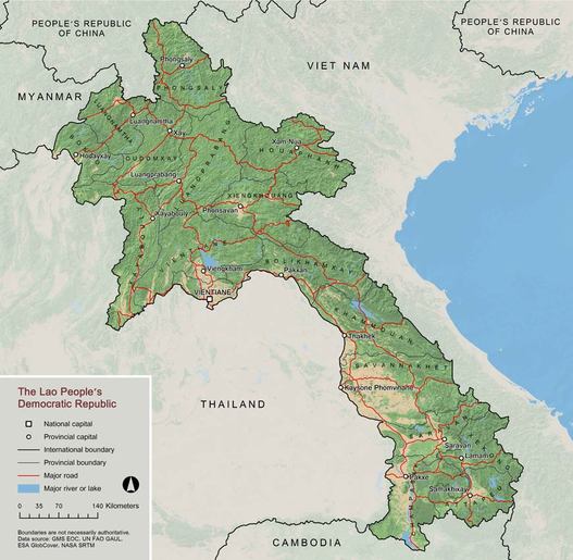
    Savannakhet Province, Lao People’s Democratic Republic (PDR), is a small area that is connected to Thailand, other areas of Lao PDR, and Vietnam via road No. 9. This province has been increasingly affected by carbon dioxide (CO2) emitted from the transport corridors that have been developed across the region. To determine the effect of the CO2 increases caused by deforestation and emissions, the total above-ground biomass (AGB) and carbon stocks for different land-cover types were assessed. This study estimated the AGB and carbon stocks (t/ha) of vegetation and soil using standard sampling techniques and allometric equations. Overall, 81 plots, each measuring 1600 m2, were established to represent samples from dry evergreen forest (DEF), mixed deciduous forest (MDF), dry dipterocarp forest (DDF), disturbed forest (DF), and paddy fields (PFi). In each plot, the diameter at breast height (DBH) and height (H) of the overstory trees were measured. Soil samples (composite n = 2) were collected at depths of 0–30 cm. Soil carbon was assessed using the soil depth, soil bulk density, and carbon content. Remote sensing (RS; Landsat Thematic Mapper (TM) image) was used for land-cover classification and development of the AGB estimation model. The relationships between the AGB and RS data (e.g., single TM band, various vegetation indices (VIs), and elevation) were investigated using a multiple linear regression analysis. The results of the total carbon stock assessments from the ground data showed that the MDF site had the highest value, followed by the DEF, DDF, DF, and PFi sites. The RS data showed that the MDF site had the highest area coverage, followed by the DDF, PFi, DF, and DEF sites. The results indicated significant relationships between the AGB and RS data. The strongest correlation was found for the PFi site, followed by the MDF, DDF, DEF, and DF sites.

    remotesensing​-06​-05452.pdf (1 MB)
View map

LAO PDR

View map

Mekong River Basin